Sunday, 20 July 2014

Pico Arieiro to Pico Ruivo - Madeira

We could not leave Madeira without hiking between the two largest peaks on the island. Again, we were blessed with fantastic views. The weather, being above the cloud base was hot......hotter than the hinges of hell!


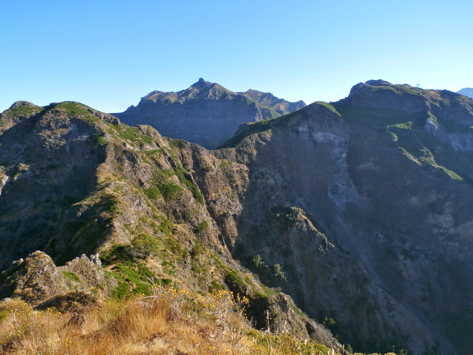
From the observatory at Arieiro the start of the path is well made. Ruivo in the distance, right of picture.


After quite a steep descent the path levels out, sort of, to be rewarded with amazing views.


We chose the short route out, which around Pico Gato heads north through a couple of tunnels, fighting off hords of goblins and such vile creatures that blocked our way.


A long steady ascent to Ruivo, evidence of the recent fire still visible.


Finally, the peak, with more glorious vista`s. Looking north east over Teixeira,  


A government/forestry house just below the summit of Pico Ruivo, the "Red Peak" is the islands highest point at 1862m.


Pico Ruivo is a junction for a number of cross island trails. Next time maybe! We had to get back across to Arieiro.


Evidence of a massive landslide that blocked the route back.


We decided to take the longer route back across, luckily the path was waymarked, probably by Arnie Saccnuson on his "Journey to the center of the Earth".


This route probably adds around an hour to hike back to Arieiro, and luckily for us we start the steep ascent in the baking heat. The entrance to The Mines of Moria cut into the rock above the path, definitely orcs in there!


The final few metres back up the well made path to the start point and a well earned ice cream.


Saturday, 19 July 2014

Boca da Corrida to Pico Grande - Madeira -

While on the beautiful island of Madeira Marty and I decided to head into the mountains for a peak around. Thanks to a fantastic book of Madeira Walks we chose to head to Pico Grande.


The vista from the viewpoint at Boca da corrida is awesome. Looking north to the central massif our destination is.....one of them peaks over there somewhere. The town of Curral das Freiras is far below, in the valley below the mist.


Sao Cristovao shrine at Boca da Corrida.


We where blessed with amazing views over the south of the island looking out to the Atlantic, which is below the cloud base.


Extensive views north west from the path.


Our destination finally comes into clear view. Pico Grande ahead. The path undulates often and the natural land bridge ahead was our next mark.


To gain the summit, a further ridge, in the center had to be crossed, the summit accessed via the col on the right of Pico Grande.


In 2012 a massive fire swept across parts of Madeira of which some evidence is clear. Most of the area has recovered remarkably well.


Ahard push to the summit and we were rewarded with extensive vies over to Pico Arieiro (1816m) and the highest point on the island Pico Ruivo (1862m).


Marty taking a well earned rest on the summit, looking very "Matrix" like.


The return required us to retrace our steps, with the cloud base lifting the views were very different. Curral das Freiras below.

Monday, 5 August 2013

Torridon Adventure - 27th July - 3rd August

After completing the national 3 peaks last year I promised I would return to Scotland to do a lot more walking. After looking through many websites, the SYHA "holiday ideas" caught my eye and I signed up for a weeks guided walking in the Torridon. On route I called in to Gairloch on behalf of a friend, Liz, to pay respects to her mother. It was rather poignant that 27th July is her mothers birthday. I said a few words on your behalf Liz, but also in the hope she would watch my step while walking in the Torridon mountains.


The hostel at Torridon was way above expectations. I was met by Emily who is super efficient. The facilities at the hostel are excellent. At night I met with my companions for the week, Ann, Liz and Paul at a briefing given by Jim Sutherland, from nineonesix guiding. The itenary was subject to change due to the varying weather conditions so it was decided to walk up Beinn Alligin on the Sunday.


This view taken from from the other side of Upper Loch Torridon shows the tops of Beinn Alligin covered in mist. Our route was up the central corrie to the first Munro, clockwise to the second Munro, around and over the Horns of Alligin on the right.


At the top of second Munro looking over to The Horns of Alligin in the foreground. Not the best day to be taking pictures, we were more worried about keeping our footing on the loose and slippery rock.

The second day we took in Maol Chean Dearg. A long walk in from Annat via Loch an Eoin. Summit views were a big improvement on yesterdays walk up Beinn Alligin.


The highlight of the return walk was being able to watch a Golden Eagle and its young soaring high above. Its young appeared to be practicing diving. For a good 15 mins we were captivated. My first view of a Golden Eagle. We also managed to get a clear view towards Liathach, pictured below. This walk being kept for the best day of the week.


On to Tuesday, and another long walk to our objective, Slioch, from Kinlochewe. Roughly a 12 mile round trip but the views are well worth the time and effort. Below, on of the many inlets to Loch Maree.


The views over to Torridon are beautiful, but it`s the view to Fisherfield and that really takes the breath away. Loch Garbhaig and Lochan Fada below, taken from the summit of Slioch.


Loch Maree below. The small group of islands in the centre have a number of myths surrounding them. You must not take anything of the islands and even the local fisherman clean the mud from there boots before leaving them.


 Below, the view towards Torridon.


We had hoped for some fine weather for Wednesdays trek up Liathach. This was not to be I`m afraid. On nearing the summit after a very steep climb the clouds closed around us and picture taking was impossible. The pictures below taken near the summit.


The day was not wasted by any means. Jim, our guide from nineonesix made it as entertaining as possible by scrambling over a number of pinnacles. In some ways I think we were glad we couldn`t see the steep drops around us.


A rest day was planned for Thursday, and it was sorely needed. I took a drive around the coast to Applecross and over the highest road in Scotland, the Bealach na Ba.


Above, looking towards Skye and Raasay. Below, taken from the bottom of Bealach na Ba.


For our final days trek, Jim took us up Beinn Eighe. This proved to be the highlight of the week for me. We were blessed with good weather and a slight breeze kept the midges away.We parked cars at Glen Torridon and made our way on a well defined path around the north west slopes of Liathach, this picture shows one of its corries on its northern  side.


Here we took a good rest stop to refuel, but also to admire the awesome Coire Mhic Fhearchair with its famous triple buttress. Our path up is to the extreme left of the picture, up the boulder field and on to Ruadh-stac Mor.


 Taken looking north east to Loch Marree.


Taken on the final ridge walk to Beinn Eighe.


We had a final meal at The Torridon Inn which included a debrief by our guide Jim Sutherland. What more needs to be said about an amazing week in a truly wonderful place. The staff at SYHA Torridon could not have made us more welcome. Thank you to Jim Sutherland from nineonesix guiding. We were also priveliged to stay at the hostel with a gang of men who`s job is to repair the erroded paths around the Torridon mountains. These guys make our ascents and descents a lot easier for us mortals, thanks men.


Final goodbyes to Ann, Liz and Paul, thank you for a marvellous week. I left Torridon on a very damp Saturday morning, but the rainbow gave me sign that the request I made a week ago at Gairloch cemetery had been granted.


Sunday, 14 July 2013

Cwm Llan horseshoe and Crib Goch

A weekend to explore the outlying peaks of the Snowdon Massif.


The start of the Watkin Path was used to tackle the Cwm Llan horseshoe. The approach to Afon Cwm Llan from Nantgwynant.


The famous slab bridge crossing. The ascent to Gallt y Wenallt our first objective proved rather a long trek from here, passing the unused mine works and it being a rather steep climb.


The approach to Y Lliwedd left of picture and Snowdon right. The steep scree path heading to the left of Snowdon`s peak is just visible.


The cobalt blue water of Llyn Llydaw. Crib Goch center of picture.


Mindful not to stray to close to the edge when taking pictures. The summit of Y Lliwedd.


The summit of Snowdon was heaving with people, as expected. A quick descent to Finger rock for a break to examine our descent of the South Ridge. The summit of Moel Hebog in the distant background.


 After a rest stop at Bwlch Cwm Llan, with tyred legs we decided to take on Yr Aran. The views of the Snowdon Massif are spectacular. Y Lliwedd right of picture, Snowdon left of center and the descent of the south ridge can clearly be seen. All that remained was a final descent of Yr Aran back to Nantgwynant. A fantastic day in the mountains.

Day 2 was used to catch a long overdue appointment with the infamous Crib Goch.


The ascent from Pen-y-pass was uneventful. That was until we approached the ridge line were a final drink, tighten ones rucksacks and bootlaces and away we went.


After the ridge line the tricky passing of the pinnacles caused a few headaches.


A retrospective view of the ridge when approaching Garnedd Ugain.


The grassy summit of Garnedd Ugain with a superb view of the ridge line from Snowdon to Y Lliwedd and Gallt y Wenallt. A descent to Pen-y-pass via the extremely busy Pyg track could not diminish was what an amazing weekend in the mountains.