Tuesday, 5 June 2018

Mary Jones Walk


                      Mary Jones, born 1784, was from a poor family. She lived in a small village called Llanfihangel-y-Pennant, situated at the foot of Cadair Idris, in the southern end of Snowdonia National Park. Her parents were devout Methodists. It was Mary`s desire to own her own Bible as the nearest copy she could read was some two miles away. As a result, Mary saved up enough money to buy her own. It took her six years to do so, but the nearest place she could purchase a Bible was in Tegid (Bala), some 28 miles away. One morning, in 1800, she set off to Bala, walking through mountainous terrain, to buy her own Bible from the Rev Thomas Charles. I`m not sure were I originally heard the story of Mary Jones, but I felt inspired to pay my own respects to her dedication and her belief, by walking the route she did.


Tyn-y-Ddol, the cottage where Mary was brought up, now with a memorial.


The cottage Tyn-y-Ddol is the obvious starting place for the journey. A short walk up the lane will bring you to the church of St Michael in Llanfihangel-y-Pennant, it was open and there is a exhibition of her story. It was worth taking the time to look around, it is a very special place.


St Michaels church in Llanfihangel-y-Pennant

Just a short walk from the church is a fantastic site, well worth a visit. Castle-y-Bere. Built around 1220 it was one of several castles built by Llewelyn the Great. The forces of King Edward 1 laid siege to the castle and it fell in 1282. Then retaken by the Welsh in 1294, apparently. Subsequently it fell in to ruin and is a rarely visited tourist attraction.


Initially, I headed through he mountain pass leaving the valley of Cwm Llan and heading for the Taly-Lyn valley. You would pass an old slate cottage. The cottage is long derelict with a Rowan tree growing from its chimney, there are several box and fruit trees in the garden.


 Looking back towards the Tal-y-Lyn lake you can just make out the parish church were Mary married Thomas Lewis Jones in 1831.


After 5 miles I entered Minffordd were I was glad to fill my water bottles and have some food. The next stage of the journey would be 6 miles and to the campsite I had planned to stay for the night, aware that a thunderstorm was behind me and would be chasing me all the way there. 


Now entering the expanse of the Cwm Hafod Oer valley I could see Aran Benllyn and Aran Fawddy to my right as I passed an old cowshed with an Icthus sign on the from wall. The Icthus fish has been a sign of Christianaity for 2000 years. 


Further on I walked through a beautiful wood, the grass verges are filled with wildflowers, the country lanes lined with Hazel and Oak.


On nearing the end of the second leg of my journey I passed Gwanas Farm, originally a hospice of the Knights Hospitaller Order, established before 1338.


While walking along a walled road I looked to my left to see magnificent views of Cadair Idris, and I realised just how far I had come. 


I soon found the campsite at Brithdir, weary after my 11 mile walk. It didn't take me long to set up my tent, eat and I fell in to a deep sleep, oblivious of the storm outside. The storm had passed over by morning so I waited for the tent to dry before packing it away. I had another 11 mile hike to do before I reached my next stop at Llanuwchllyn.


I left Brithdir and headed west along an old Roman Road Rhydmain. The walk was getting harder and my stops more frequent. However, the solitude was very comforting and I couldn`t help wonder how Mary Jones coped, probably a lot better than I was coping, I should think. 


There were beautiful views all around and walking alone through old country paths lined with ancient trees, pasture  land filled with wild bluebells and violets.


From the time I left Brithdir, some 5 miles past, I had not come across a single person on my walk, until a local farmer told me the storm had passed over to Bala and he wasn't expecting any rain until the evening. My backpack was heavy,there was a break in the cloud so I took the opportunity to rest by a beautiful Rowan tree, allowing myself time to listen to my favourite piece of music by Vaughan Williams, The Lark Ascending.


Bala finally came into view, although it would take me another couple of hours to reach the campsite at Llanuwchllyn.


I passed fantastic views of The Arenigs to my left, some walking in hills I have yet to do.


The path to the campsite took me past Pont-y-Pandy bridge. In 1781 the original bridge was swept away by a deluge. Sally Jones from Bala, later to become the wife of Thomas Charles, mentioned at the beginning of our journey, was almost lost. I spotted a lone heron in search of its food, which reminded me!!!!


The campsite at Llanuwchllyn was busy, a Bank Holiday Vintage Fair with exhibitions of tractors and such. Unfortunately the thunderstorms scattered the crowds. I huddled in my tent, forcing myself to get out and walk the 200 meters or so to freshen up. I soon found a table in the corner of the local pub and had a delicious meal and a very well earned drink of the local ale.


Once again, the weather in the morning favoured me. I spoke to a family of campers who couldn't believe I slept through the torrential rain that fell during the night. The inside lining of my tent was wet, which made my sleeping bag wet as I brushed against during the night. I had my last protein bar for breakfast and packed up my tent. I was aiming to reach Bala for lunch. The weather was warming up and the air was clear for my last few pictures as I set off for the last 6 miles around Bala Lake.


Again, I was alone as I walked avenues of trees and the beautiful valley of Glyn Gywer.


It was an easy choice to have a rest stop overlooking Bala Lake (Llyn Tegid).


I entered Bala around midday and found my way to the original site of Thomas Charles home. I wondered what site greeted Thomas when he opened the door to Mary, clutching her savings, having walked around 28 miles to his home to buy her own bible. I do know I would never have the strength of mind or body to carry out the walk in the same conditions as Mary did......barefoot.


Sunday, 6 September 2015

The Wild Atlantic Way, Connemara, Ireland

Cheap flights and a few days off work were all we needed to get away to do some walking in totally new surroundings. We stayed in a number of Airbnb homes, which proved to exceed our expectations. We flew into Knock and headed straight for Westport.


Just outside of Westport lies Croagh Patrick, the "Holy Mountain or "Reek" as it can be known, don`t ask me why. I just know we put sunscreen on at the bottom and waterproofs on at the top, the weather is so changeable. As the saying goes, "If you don`t like the weather in Connemara, wait five minutes"
Every year there is a mass pilgrimage up the mountain and some people actually do the walk in bare feet. All in honour of St Patrick.


We decided to stay on the beautiful Clare Island for the peace and quiet, and to walk up Knockmore. The picture below was taken at Roonagh pier looking over at the island, while waiting for the ferry.


Once settled in to Anna`s coffee shop we set off in search of Knockmore, quite a long walk to the summit via the lighthouse.


Below was taken from close to the lighthouse looking back to the mainland and yesterdays walk up Croagh Patrick.


The view along the cliffs to our destination. Care had to be taken on the route, there was a landslide a couple of years ago.


There were quite a lot of ups and downs on the way, not what was expected, but worth the effort. The weather had closed in once at the top so not much scope for picture taking.


The beach at Clare, with the community centre and Sailors bar and restaurant on the left.


On our tour of the Wild Atlantic Way we stopped at the Lost Valley, a most amazing beach "Uggool Sands"


Kylemore Abbey, once a Benedictine Monastary, then a girls school, now a tourist attraction.


A one night stop at Letterfrack. We were able to walk up Diamond Hill, a popular route due to the summit having fantastic views. The one below looks out to Tully mountain and the Atlantic ocean.


The weather held out and we were blessed with glorious views of the Twelve Bens. The path leads you down through the Bog Road back to Letterfrack.


Another drive on the Wild Atlantic Way took us toward Roundstone. We stopped short and parked our car by Dog Bay and walked along the Bog Road until we found a suitable line to the summit. For such a small height gain it was surprisingly tough going with no obvious paths or tracks.


The views are extensive and worth the effort. Below is the peninsular to the south with Dogs Bay and Gorteen Bay.


One could`t drive the Connemara Loop without visiting the most beautiful village of Cong, full of history besides it being the location of the John Wayne/Maureen O`Hara film The Quiet Man. We arrived at the village just before the bus loads of tourists were due and were able to ramble around the village at our leisure.


There are the ruins of the Augustinian Abbey dating back to the 13th century. The picture below is of the monks fishing cottage on the river and contains a trap door were a net was sunk to catch the fish, not really fishing I suppose but efficient.


We finished off our tour in Galway with the odd pint of Guiness, some good food, and a promise to return, maybe take in those Twelve Bens???

Sunday, 20 July 2014

Pico Arieiro to Pico Ruivo - Madeira

We could not leave Madeira without hiking between the two largest peaks on the island. Again, we were blessed with fantastic views. The weather, being above the cloud base was hot......hotter than the hinges of hell!


From the observatory at Arieiro the start of the path is well made. Ruivo in the distance, right of picture.


After quite a steep descent the path levels out, sort of, to be rewarded with amazing views.


We chose the short route out, which around Pico Gato heads north through a couple of tunnels, fighting off hords of goblins and such vile creatures that blocked our way.


A long steady ascent to Ruivo, evidence of the recent fire still visible.


Finally, the peak, with more glorious vista`s. Looking north east over Teixeira,  


A government/forestry house just below the summit of Pico Ruivo, the "Red Peak" is the islands highest point at 1862m.


Pico Ruivo is a junction for a number of cross island trails. Next time maybe! We had to get back across to Arieiro.


Evidence of a massive landslide that blocked the route back.


We decided to take the longer route back across, luckily the path was waymarked, probably by Arnie Saccnuson on his "Journey to the center of the Earth".


This route probably adds around an hour to hike back to Arieiro, and luckily for us we start the steep ascent in the baking heat. The entrance to The Mines of Moria cut into the rock above the path, definitely orcs in there!


The final few metres back up the well made path to the start point and a well earned ice cream.


Saturday, 19 July 2014

Boca da Corrida to Pico Grande - Madeira -

While on the beautiful island of Madeira Marty and I decided to head into the mountains for a peak around. Thanks to a fantastic book of Madeira Walks we chose to head to Pico Grande.


The vista from the viewpoint at Boca da corrida is awesome. Looking north to the central massif our destination is.....one of them peaks over there somewhere. The town of Curral das Freiras is far below, in the valley below the mist.


Sao Cristovao shrine at Boca da Corrida.


We where blessed with amazing views over the south of the island looking out to the Atlantic, which is below the cloud base.


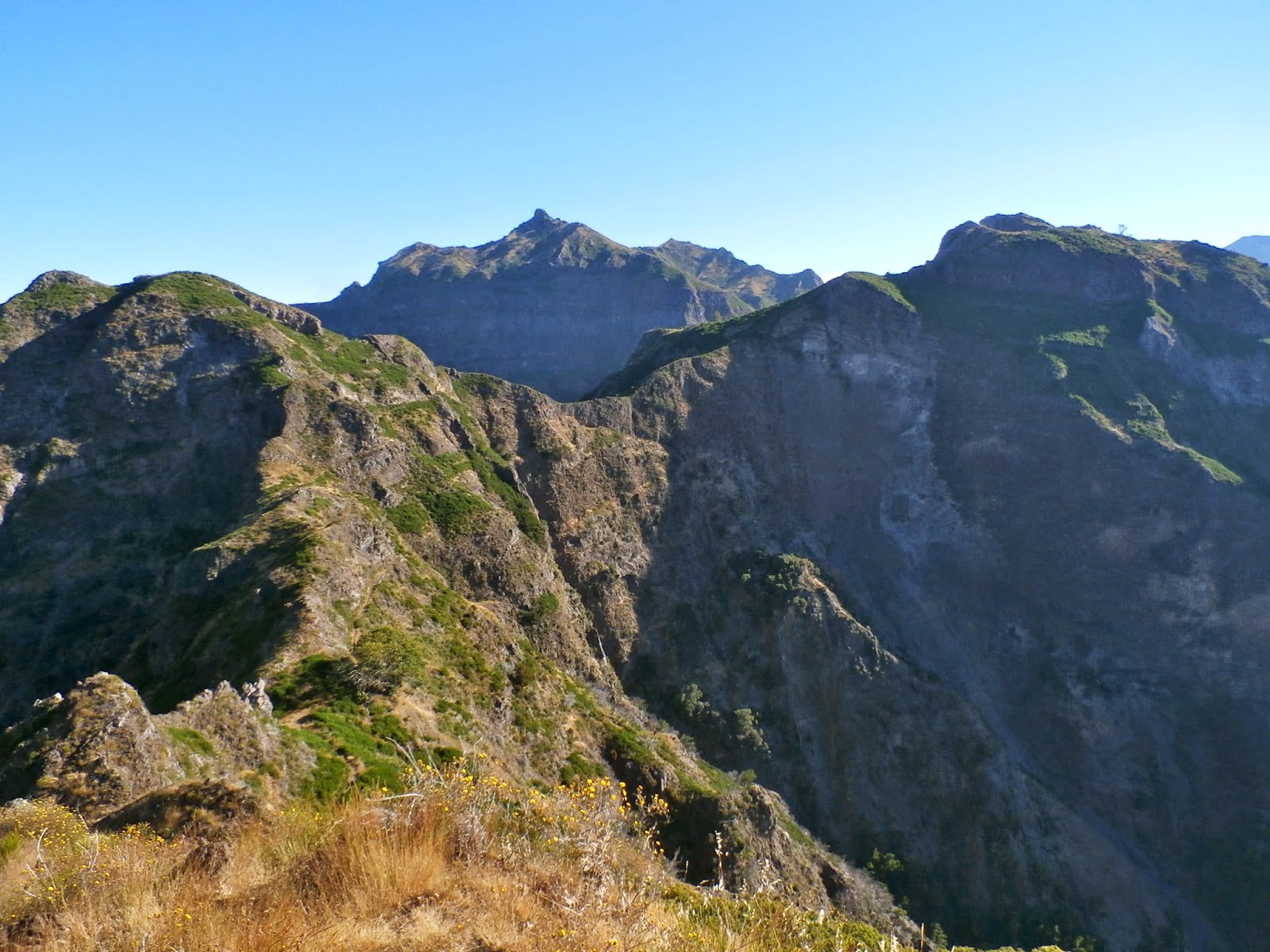
Extensive views north west from the path.


Our destination finally comes into clear view. Pico Grande ahead. The path undulates often and the natural land bridge ahead was our next mark.


To gain the summit, a further ridge, in the center had to be crossed, the summit accessed via the col on the right of Pico Grande.


In 2012 a massive fire swept across parts of Madeira of which some evidence is clear. Most of the area has recovered remarkably well.


Ahard push to the summit and we were rewarded with extensive vies over to Pico Arieiro (1816m) and the highest point on the island Pico Ruivo (1862m).


Marty taking a well earned rest on the summit, looking very "Matrix" like.


The return required us to retrace our steps, with the cloud base lifting the views were very different. Curral das Freiras below.